The Performance of the Form
How graceful science can make urban beauty, and the limits to getting there

The physical world that we inhabit matters. A lot.
Even if large parts of our lives have moved to the digital space and are shaped by seemingly immaterial technologies, material forces still determine our destinies. Starting with our bodies, and continuing with our homes and the places in which we live. Narrow sidewalks and the zig‑zag of alleyways guide who meets whom and how often. Even as half our day flickers through screens, bricks and asphalt still decide rental prices, school catchments, and respiratory health.
This is so evident, perhaps precisely because it’s so evident, that we often forget it.
Policy experts love abstractions: agglomeration economies, housing supply or green growth, but often forget the building heights, block length, or shade canopy that put those forces in motion. They, we, often talk and think about cities as if they were just ideas, not mixes of concrete, glass, trees, and grass.
One of the reasons for this scant attention to the built-environment is that it’s very hard to measure and model how street geometry shapes wages or carbon emissions.
But that may be changing.
Researchers like Ramon Gras have spent years studying these questions and they summarize what they have found in a crisp phrase that gives its name to an elegant book: “City Design: Performance follows form”. The thesis is simple: the measurable geometry of streets, parcels and land‑use patches predict social, economic and environmental performance. Recently, Ramon did two excellent podcast interviews with Douglas Stuart McDaniel at Citizen One. I urge everyone to listen to those before or after reading this.
Here I want to share some reflections on a few of Ramon’s ideas, he has plenty, which I hope to explore directly with him in the near future.
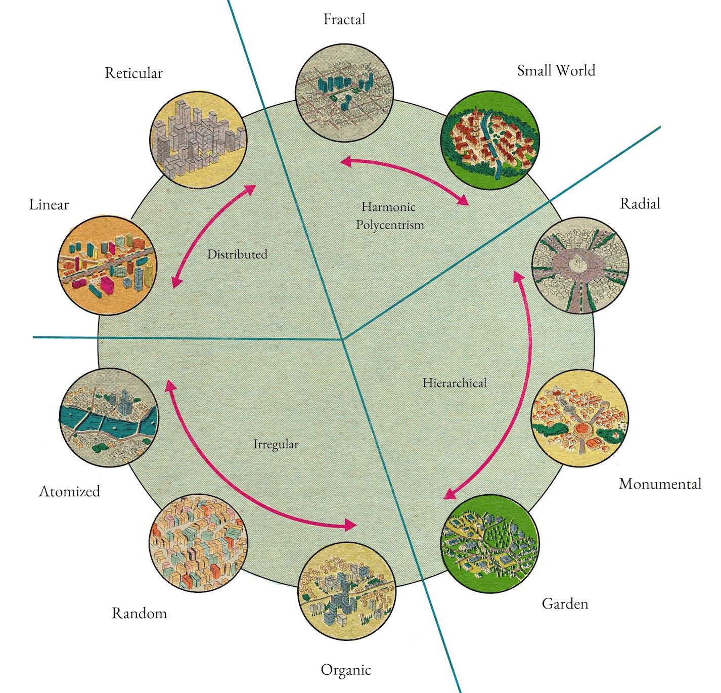
Beautiful Fractals
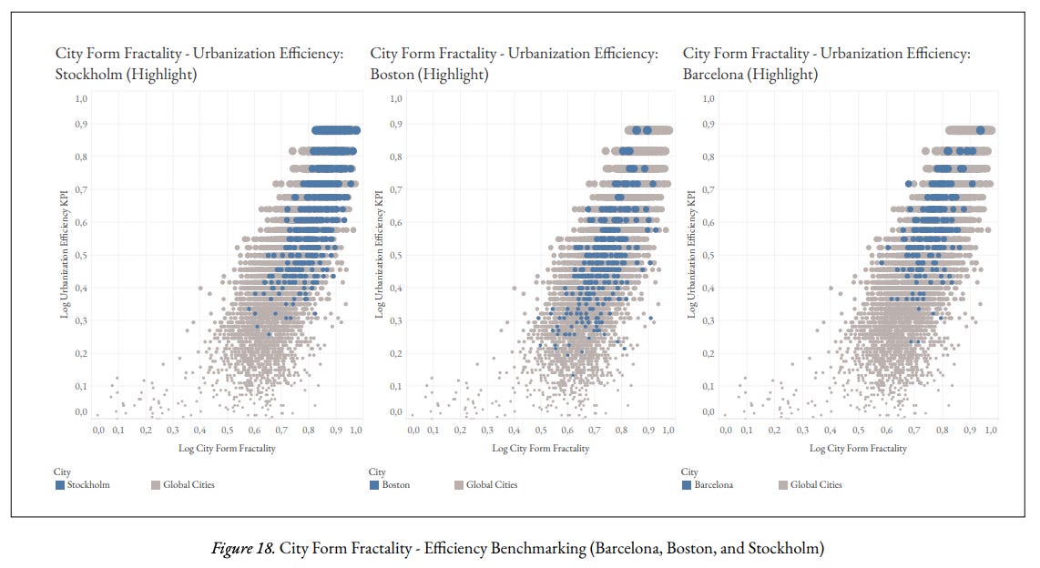
Ramon and his team at Aretian Urban Analytics and Design argue that five measurable features, fractality, entropy, network centrality, mixed-uses interspersion and polycentric hierarchy, predict innovation, income, and liveability. The book goes in-depth into the indicators and the methodology for both city form indicators and the outcome metrics, so I want to focus on one of its core features: fractality.
Wait. What exactly is a fractal?
A fractal is a pattern that repeats its basic shape at multiple scales. The way a fern leaf echoes the whole plant, or millions of snowflakes add their iconic shape to form a snow blanket. In cities, think of a gridded street that mirrors itself in tiny service alleys and in metropolitan ring roads. Self‑similarity lets humans navigate intuitively and lets urban systems distribute flows efficiently.
When evaluating urban design excellence across 100 global cities, from Chicago to Rio de Janeiro, Buenos Aires to Tokyo, Shanghai to various Indian cities, Ramon and his team discovered that most cities score between 40-60 in a 0 to 100 normalized measure of fractality.1 Better-designed cities exceed 70, with the best ones scoring above 80. Top performers in fractality excelled at human interaction levels, but also showed higher real estate prices.
My first reaction was somewhat skeptical: ‘this sounds cool, but how do you marry the beauty of widespread fractals with the benefits of concentration?’ If the fundamental advantage of cities is the economic value (surplus in Ramon’s terms or spillovers for economists) derived from agglomeration, isn't this lost if we transform the city into a patterned mosaic of similar neighborhoods? Doesn’t scattering “mini‑cities” dilute agglomeration gains?
Ramon has a brilliant take on this conundrum. He talks about multiple scales with varying complexities and sophistication of activities. The more simple activities, like groceries, primary health-care, retail, restaurants or education need to be distributed in an egalitarian way throughout the urban fabric. These are the core fractals. But as we move up the ladder of the sophistication and uniqueness of economic activities, for example universities, technology centers, or hospitals, these need to be concentrated to generate the surplus benefits of agglomeration accruing in cities.
The relationship between fractality and agglomeration can be symbiotic rather than contradictory. The key is to get "nested" agglomerations, neighborhoods within districts within cities, each operating at its optimal scale and well connected to each other.
The Promises of Data-informed Urbanism
I started by saying that we often ignore how urban form affects urban living, but that’s mostly true for economists and policy experts. Urban planners have thought about this deeply for many years. Jane Jacobs, not a planner but indeed a brilliant urban thinker, identified the morphological qualities that make neighborhoods work, but she did so primarily through observation and intuition, not quantitative analysis.
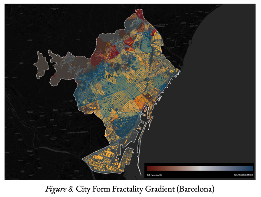
What Ramon and his colleagues at Aretian are doing is grounding those intuitions on science and data. They have already done that in Barcelona, developing a digital twin to identify the properties, advantages, and challenges of each of the 160 municipalities of the metropolitan area, deriving a desirable density range for each municipality.
“If you're really far below that, you're in trouble because socialization is increasingly hard. And if you're well above that and not in line with the morphology, you may be creating diminishing returns. So you really need to get it right for any given context.” Ramon Gras
This opens exciting new possibilities for data-informed urban policy and design. For instance, when we observe that neighborhoods with fractality scores above 75 consistently outperform those below 50 in terms of innovation and social cohesion, we can target interventions to enhance fractal qualities in underperforming areas. This might mean adding strategic connections between isolated street networks, varying building heights to create self-similar patterns, or designing public spaces that echo the architectural rhythms of surrounding structures.
Data doesn't just tell us what works. It tells us specifically how and where to intervene for maximum impact.
The Challenges: Endogeneity, Stickiness, and Actionability
The vision of a data-informed urbanism to improve the design of our cities is enticing, to say the least. But it also comes with limitations. There are, at least, three tensions that I would love to discuss with Ramon Gras.
The Endogeneity Problem
The old adage of correlation is not causation holds here.
Wealthy areas often have the resources to invest in high-quality urban design. They can afford varied architecture, pleasant public spaces, and well-connected street networks—all contributors to high fractality scores. But what if there are other factors such as the structure of the city’s economy, its wealth, or even macro-economic trends or legal environments and traditions that aren’t visible in the measured indicators, but actually explain the relationships that we see in the data?
Establishing causality would demand the use of experimental methods with longitudinal data. The latter may exist, but conducting experiments where the intervention is the building of neighborhoods or connective infrastructures is extremely difficult, if not impossible. These interventions are multifaceted, take decades to consolidate, and have multiple and inter-related interactions that take long to produce effects.
This leads me to the second issue.
The Stickiness of the Built Environment
Cities are not software. We can't just update to version 2.0 overnight. Quite the opposite, streets laid out one hundred years ago still define movement patterns today. This has three implications. An obvious one is that, unless you are operating in a green field city, there are many constraints to what you can actually do, design, and build. Second, you cannot easily test interventions and evaluate their impact. This further complicates the issue of disentangling causation from correlation. Lastly, once infrastructures are built and streets are laid out, they cannot be reversed. At least not without incurring painful and massive costs.
Precisely because these decisions are so costly and often irreversible, urban planning and building entails complex and lengthy processes. And this takes me to the third potential tension that I want to discuss with Ramon.
From Analysis to Action
It's one thing to identify that a neighborhood has suboptimal fractality or entropy scores. It's quite another to translate that insight into actionable policies for city governments and the people that run them.
Municipal authorities work within specific regulatory, budgetary, and political constraints. They control some aspects of urban form (public infrastructure, zoning regulations, certain policies and budgets) but the ones outside their powers are probably more, and often more relevant. Achieving fractality or increasing density also demands acting on aspects that span the competencies of any one public official, department, or even city hall. Not to talk about the time-lag that we already mentioned between decisions and effects.
As a result, decision-makers who are advised to improve their city’s fractality or density may, on a good day, ask “how does this translate into decisions that I can take tomorrow, next month, and over the coming three years?”. On a bad day… they’ll just marble at the mathematical elegance of fractals and carry on fighting their latest fire.
Some urbanists or urban scientists may not see this as their problem. It’s already hard to design the models that they are developing, to also have to worry about the dull and “small p” politics of implementation. I understand them, but I disagree. Profoundly. If we ignore these complexities, many of them human and hard to model, we’ll have magnificent and sophisticated models, but we’ll still be stuck in traffic, walking through poorly designed streets, trying to make ends meet in economically decaying cities, and sleeping in unhealthy buildings.
A measure of city form self-similarity from 0-1: Urban form is organized in a self-similar, hierarchical nested fashion whereby there are large central features surrounded by a second tier and then interspersed with Tier 3 and subsequent tiers’ features. Features can include residential spaces, economic activity, hospitals and education systems, parks, transportation hubs, etc. The higher the number, the greater the fractality and, subsequently, the higher the economic performance (Source: City Science: Performance Follows Form).